

You can find on this page the China airports map to print and to download in PDF. The map of China airport presents details of location and international airports of China in Asia.

The China airports map shows location of airports in China. This airports map of China will allow you to determine which airport you will used to leave or arrive in China in Asia. The China international airports map is downloadable in PDF, printable and free.
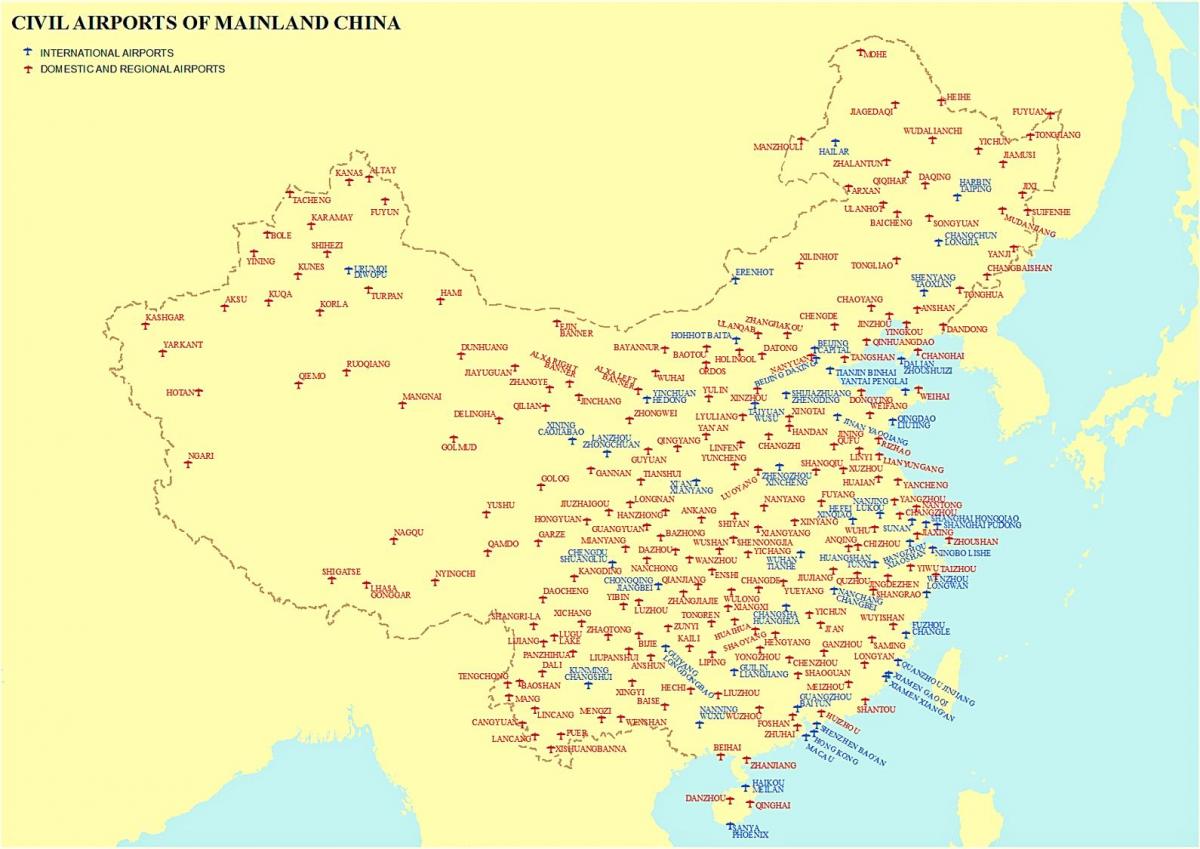
As a result of the rapidly expanding civil aviation industry, by 2007 China had around 500 airports of all types and sizes in operation (see the map of China airports), about 400 of which had paved runways and about 100 of which had runways of 3,047 m or shorter. There also were 35 heliports in 2007, an increasingly used type of facility. With the additional airports came a proliferation of airlines.
China is served both by numerous major international flights to most countries of the world and a host of domestic regional airlines. At present, there are more than 200 airports in China that travelers can take flight to many cities of China, including as you can see in the map of China airports Beijing, Shanghai, Chengdu, Xian, Guilin, Lhasa, Chongqing, Kunming, Lijiang, Shangri-La, Hangzhou, Huangshan, Shenzhen, Xiamen, Wuhan, Urumqi, Kashgar, Guiyang, Hohhot, Harbin, etc.
By 2010 (the end of the 11th Five-Year Plan), the China expects to have 186 new airports, which includes 3 national hubs, 7 regional hubs, 24 medium hubs, 28 medium airports and 124 small-size airports as its mentioned in the map of China airports. The total investment will be $17.7 billion. It is estimated that the number of airports with scheduled airlines will be 260 by 2015.