

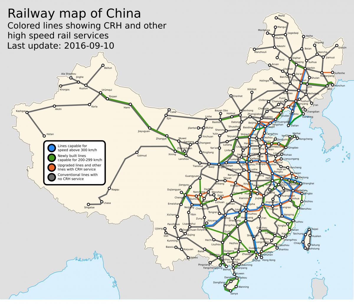
You can find on this page the China trains map to print and to download in PDF. The China railways map presents the rail network and shows high speed rails routes of China in Asia.
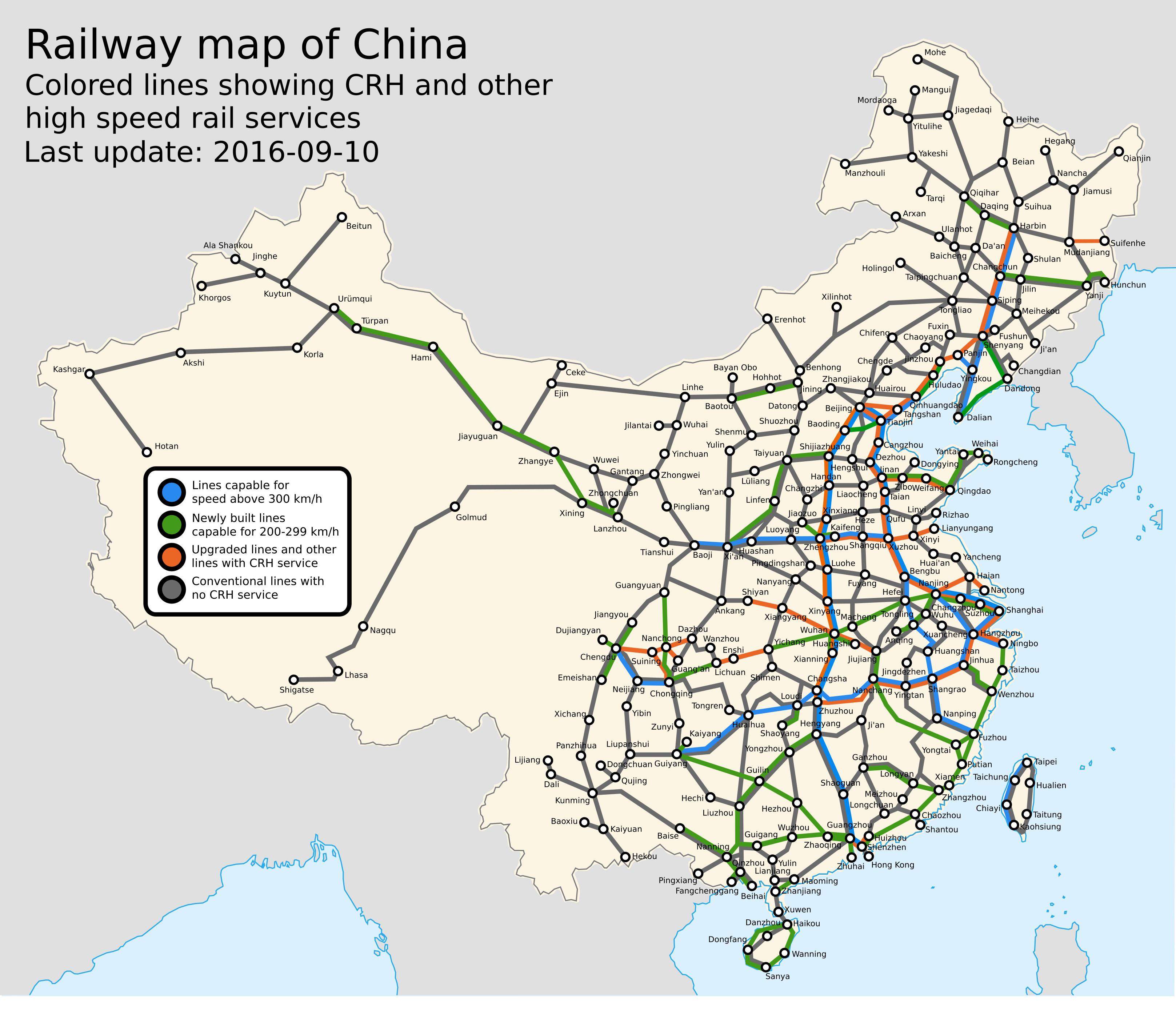
The China rail map shows all the railway stations and lines of China trains. This train map of China will allow you to easily travel by train in showing the major rail routes and high speed rail routes of China in Asia. The China rail map is downloadable in PDF, printable and free.
China passenger railways are mostly used for medium- and long-distance travel, with few trains stopping anywhere but at major stations in center cities as its mentioned in China rail map. Commuter rail systems, characteristic of large European and North American cities, are uncommon in China. However, Beijing Suburban Railway recently started operating, and Guangzhou-Zhuhai Intercity Mass Rapid Transit is under construction.
The only railway link China has with a neighboring country that does not have a break of gauge is with North Korea as you can see in China rail map. It also has a links with Kazakhstan, Mongolia and Russia, which all use the 1,520 mm (4 ft 115⁄6 in) gauge and with Vietnam, where the 1,000 mm (3 ft 33⁄8 in) gauge is still in use. China does not have a direct rail link with Afghanistan, Bhutan, India, Kyrgyzstan, Nepal, Pakistan or Tajikistan, but is currently planning a link with Laos.
China has established rail links between seaports and interior export-processing zones as its shown in China rail map. For example, in 2004 Chengdu in Sichuan was linked to the Shenzhen Special Economic Zone in coastal Guangdong; exports clear customs in Chengdu and are shipped twice daily by rail to the seaport at Shenzhen for fast delivery.