

You can find on this page the China region map to print and to download in PDF. The China political map presents states, regions, provinces and surrounding areas of China in Asia.

The China regions map shows surrounding areas and provinces of China. This administrative map of China will allow you to know regions of China in Asia. The China regions map is downloadable in PDF, printable and free.
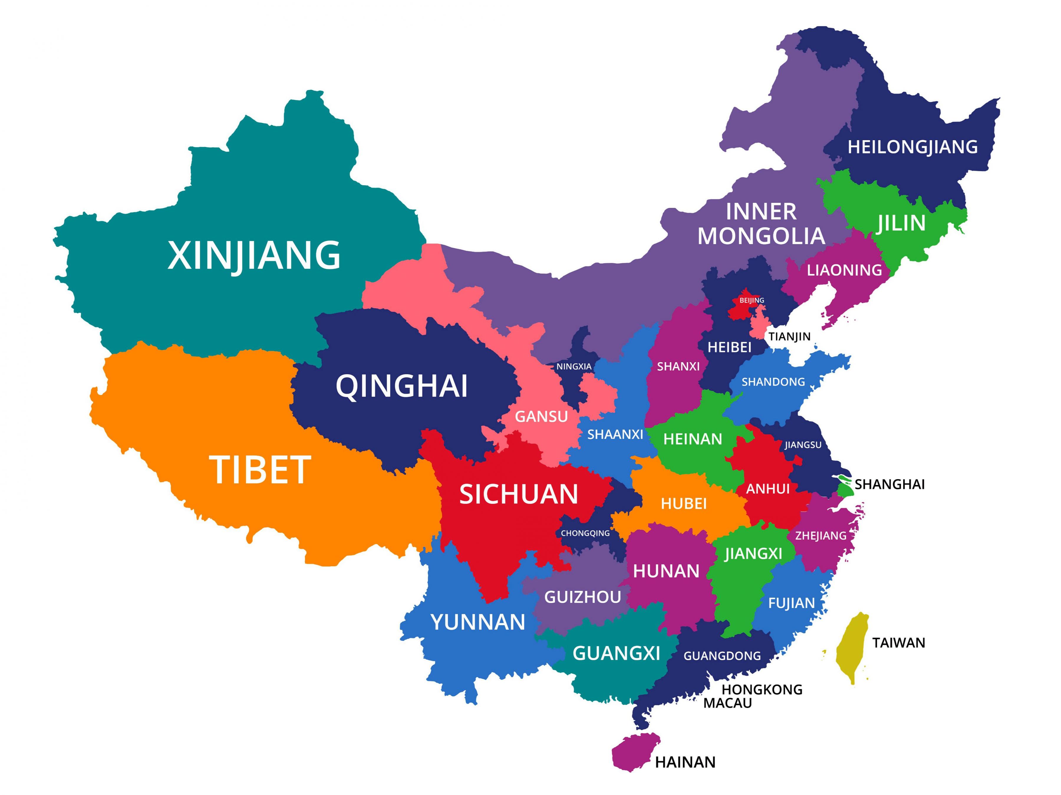
In the context of Chinese government, a province (sheng), formally provincial level division, is the highest-level administrative division. China currently administers 33 such divisions, classified as 22 provinces, 4 municipalities, 5 autonomous regions and 2 special administrative regions as its shown in China regions map. According to research by the National Development and Reform Commission (NDRC) of China, ten major metropolitan regions are forming in China. Together, they constitute about one-tenth (9.99%) of China land area, one-third (35.02%) of the country population and one-half (52.83%) of the country GDP (as in 2005).
Special administrative region (SAR) as its mentioned in China regions map (特別行政區; tèbiéxíngzhèngqū)— A highly autonomous and self-governing subnational subject of China that is directly under the Central People Government. Each SAR has a provincial level chief executive as head of the region and head of government. The region government is not fully independent, as foreign policy and military defence are the responsibility of the central government, according to the basic laws.
Autonomous region (自治区; zìzhìqū)— A minority subject which has a higher population of a particular minority ethnic group along with its own local government, but an autonomous region theoretically has more legislative rights than in actual practice. The governor of the Autonomous Regions is usually appointed from the respective minority ethnic group. China 5 autonomous regions as you can see in China regions map are: Guangxi, Inner Mongolia, Ningxia, Tibet (Xizang) and Xinjiang.

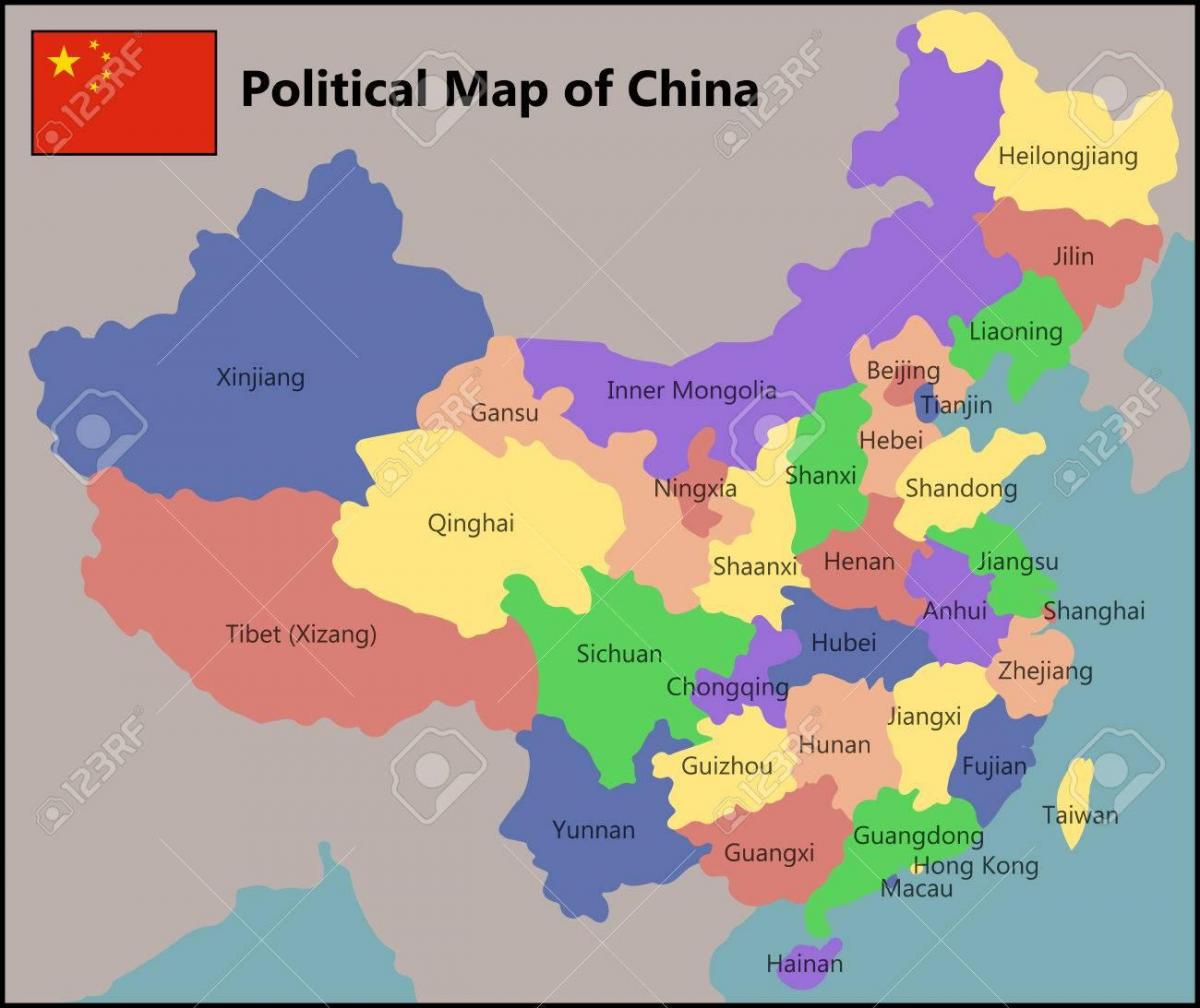
The China political map shows regions and provinces of China. This administrative map of China will allow you to show regions, administrative borders and cities of China in Asia. The China political map is downloadable in PDF, printable and free.
China political system was based on hereditary monarchies, known as dynasties, beginning with the semi-mythological Xia of the Yellow River basin as its shown in China political map (approx. 2000 BC) and ending with the fall of the Qing Dynasty in 1911. Since 221 BC, when the Qin Dynasty first conquered several states to form a Chinese empire, the country has expanded, fractured and been reformed numerous times.
China is a one-party state, with real power lying with the Chinese Communist party. The country is governed under the constitution of 1982 as amended in 1993, the fifth since the accession of the Communists in 1949 as its mentioned in China political map. The unicameral legislature is the National People Congress (NPC), consisting of deputies elected to terms of five years. The NPC decides on national economic strategy, elects or removes high officeholders, and can change China constitution; it normally follows the directives of the Communist party politburo. In the executive branch are a premier, who is head of government, and a president, who is head of state.
China political structure cannot be characterized so simply (see China political map). The Chinese government has been variously described as communist and socialist, but also as authoritarian, with heavy restrictions remaining in many areas, most notably on the Internet, the press, freedom of assembly, reproductive rights, and freedom of religion. Its current political/economic system has been termed by its leaders as "socialism with Chinese characteristics".
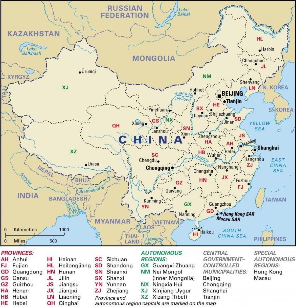
The China states map shows all departments and regions of China. States map of China will allow you to know areas and cities of China in China. The China states map is downloadable in PDF, printable and free.
States (省; shěng)— A standard provincial government is nominally led by a provincial committee, headed by a secretary. The committee secretary is first-in-charge of the state, come in second is the governor of the provincial government. China claims the island of Taiwan and its surrounding islets, including Penghu, as "Taiwan State". (Kinmen and the Matsu Islands are claimed by China as part of its Fujian State. Pratas and Itu Aba are claimed by China as part of Guangdong and Hainan states respectively as you can see in China states map.) The territory is controlled by the Republic of China (ROC, commonly called "Taiwan").
China is divided into 23 states, 22 of which are controlled by China. The 23rd state, Taiwan, is claimed by China, but it is not administered or controlled by the PRC, and is thus a de facto independent country. Hong Kong and Macau are not states of China, but are called special administrative areas. Hong Kong measures 427.8 square miles (1,108 square kilometers), with Macau at 10.8 square miles (28.2 square kilometers) as its shown in China states map.
China states create areas within the country, in a similar geographical sense to countries in the UK, or States in the U.S. These then adhere to the laws and rules set out by the central government. Xinjiang Uygur Autonomous Region is the largest state in China with an area about 1.66 million square kilometers (or 16% of China total land area as its mentioned in China states map).